


Trapper Creek Precinct, Matanuska-Susitna Borough, Alaska
About
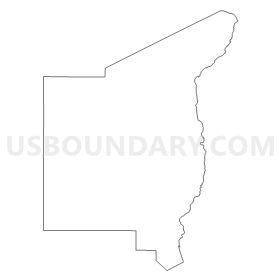
Outline
Summary
| Unique Area Identifier | 523447 |
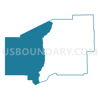
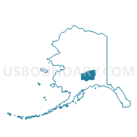
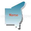
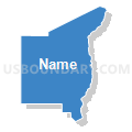
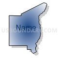
| Name | Trapper Creek Precinct |
| County | Matanuska-Susitna Borough |
| State | Alaska |
| Area (square miles) | 10,045.68 |
| Land Area (square miles) | 9,766.91 |
| Water Area (square miles) | 278.77 |
| % of Land Area | 97.23 |
| % of Water Area | 2.77 |
| Latitude of the Internal Point | 62.18397390 |
| Longtitude of the Internal Point | -151.30584430 |
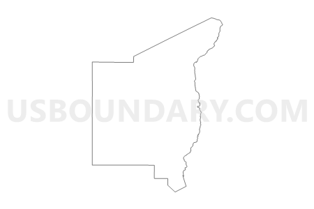
Maps

Graphs
Select a template below for downloading or customizing gragh for Trapper Creek Precinct, Matanuska-Susitna Borough, Alaska


Neighbors
Neighoring Voting District (by Name) Neighboring Voting District on the Map
- Denali Park Precinct, Denali Borough, AK
- Knik-Goose Bay Precinct, Matanuska-Susitna Borough, AK
- McGrath Precinct (Part; Also See Part In Bethel Census Area), Yukon-Koyukuk Census Area, AK
- Mcgrath Precinct (Part; Also See Part In Yukon-Koyukuk Census Area), Bethel Census Area, AK
- Nikiski Precinct, Kenai Peninsula Borough, AK
- Susitna Precinct, Matanuska-Susitna Borough, AK
- Talkeetna Precinct, Matanuska-Susitna Borough, AK
- Tyonek Precinct, Kenai Peninsula Borough, AK
- Willow Precinct, Matanuska-Susitna Borough, AK
Top 10 Neighboring County Subdivision (by Population) Neighboring County Subdivision on the Map
- Matanuska-Susitna census subarea, Matanuska-Susitna Borough, AK (88,995)
- Kenai-Cook Inlet census subarea, Kenai Peninsula Borough, AK (49,733)
- Denali census subarea, Denali Borough, AK (1,826)
- Aniak census subarea, Bethel Census Area, AK (1,450)
- McGrath-Holy Cross census subarea, Yukon-Koyukuk Census Area, AK (1,058)
Top 10 Neighboring Place (by Population) Neighboring Place on the Map
- Willow CDP, AK (2,102)
- Susitna North CDP, AK (1,260)
- Talkeetna CDP, AK (876)
- Trapper Creek CDP, AK (481)
- Skwentna CDP, AK (37)
- Chase CDP, AK (34)
- Beluga CDP, AK (20)
- Susitna CDP, AK (18)
- Petersville CDP, AK (4)
Top 10 Neighboring Unified School District (by Population) Neighboring Unified School District on the Map
- Matanuska-Susitna Borough School District, AK (88,995)
- Kenai Peninsula Borough School District, AK (55,400)
- Denali Borough School District, AK (1,826)
- Iditarod Area School District, AK (1,102)
Top 10 Neighboring State Legislative District Lower Chamber (by Population) Neighboring State Legislative District Lower Chamber on the Map
- State House District 15, Rural Mat-Su, AK (25,974)
- State House District 8, Denali-University, AK (19,960)
- State House District 34, Rural Kenai, AK (18,909)
- State House District 6, Interior Villages, AK (14,235)
Top 10 Neighboring State Legislative District Upper Chamber (by Population) Neighboring State Legislative District Upper Chamber on the Map
- State Senate District H, AK (47,533)
- State Senate District D, AK (40,942)
- State Senate District Q, AK (37,402)
- State Senate District C, AK (28,081)
Top 10 Neighboring 111th Congressional District (by Population) Neighboring 111th Congressional District on the Map
Top 10 Neighboring Census Tract (by Population) Neighboring Census Tract on the Map
- Census Tract 2, Kenai Peninsula Borough, AK (5,623)
- Census Tract 1.02, Matanuska-Susitna Borough, AK (2,181)
- Census Tract 4.02, Matanuska-Susitna Borough, AK (2,105)
- Census Tract 5.02, Matanuska-Susitna Borough, AK (1,896)
- Census Tract 1, Denali Borough, AK (1,826)
- Census Tract 3, Bethel Census Area, AK (1,450)
- Census Tract 4, Yukon-Koyukuk Census Area, AK (1,058)
- Census Tract 1.01, Matanuska-Susitna Borough, AK (620)
- Census Tract 1, Kenai Peninsula Borough, AK (373)
Top 10 Neighboring 5-Digit ZIP Code Tabulation Area (by Population) Neighboring 5-Digit ZIP Code Tabulation Area on the Map
- 99654, AK (52,168)
- 99688, AK (2,759)
- 99676, AK (1,546)
- 99743, AK (1,069)
- 99557, AK (726)
- 99683, AK (524)
- 99682, AK (373)
- 99693, AK (248)
- 99691, AK (95)
- 99667, AK (65)